A good question that a lot of us "baby boomers" are starting to think about!
A good friend, Carol Rockwood, decided to retire....so they soldl their business and moved "lock, stock and barrell" to the deserts of Arizona from Massachussetts. They had only visited Phoenix during the "winter months" so they had NO IDEA what the weather would be like in the summer time! After a summer's experience with 124 degree temps, they now go to mountainous Flagstaff for cooler, breathable air....
I don't want to make their mistake!
Seems like there are a lot of questions to answer when this subject comes up in conversation....
1. What do we want to do when we retire? Work? Fish? Volunteer? Travel? Lay on the beach?
2. Where do we want to live...one place, two places, or more?
3. When do we want to make the investment in the "place/places?"
4. How much longer do we want to work?
5. How much money do we have to have to survive old age comfortably?
6. What do we do about medical expenses and life insurance?
7. What kind of amenities do we want.....weather? town vs country? mountains vs beach?
Lots of questions need answered....
8/10/2010
7/25/2010
Back to Australia...Back Home
~~~~~~~~~~~~~~~~
It's winter down under...average daily temps in the low 70's...not too bad.
Now that I have "experienced" the ins and outs of visa problems AND seen how ridiculously expensive "things" are here, I can't say that I really want to live here any more.
You can see the Brisbane River from my 22nd story loft apartment. Rain is forecasted for most of the coming week...rather grayish and dreary if you ask me. Double click on the photo, so you can also see the D'Aguilar mountain range in the background.

So what do things cost in Australia? Know before you go!
One raw grocery store chicken = $11.30 AU Dollars
One restaurant grilled steak = $39.00
Basic monthly tv cable = $150.00/month
Internet Service = $27.00/day
~~~~~~~~~~~~
I am debating whether to spend the money to go see a few things while I am here, because I may never get the chance to do it again....such as Ayers Rock, The Great Barrier Reef, Sydney and Melbourne, the Australian wine country, etc...
Didn't make it to any of those exotic spots down under. HOWEVER, I did manage to take a ride on Brisbane's giant ferris wheel!


If I continue to have visa problems, I may have to exit Australia for a week and go to New Zealand or Tahiti, while we wait for things to get cleared up. THAT would be nice! Lots to see there too!
"Leaving on a jet plane....don't know if I'll be back again...."
Yes folks, August 11th, I'll be gone.
Here's a pic of Moscow...never been over the "Pole" before...

7/16/2010
ICE CREAM...ICE CREAM...
We all scream for ice cream!!! YEAH!!!
After this last trip to Maine, I missed my black raspberry so much that I decided to try making it myself. Most Maine creameries have it...but nobody carries this flavor in Texas!

Sometimes, if you are not looking, it will show up in the freezer case at one's local New England grocer....marketed by, who else? FRIENDLYS!!!

Here is a link to the BEST Black Raspberry Ice Cream Recipe EVER!
Even a novice like me could follow the instructions on this link...pic by pic!
The hardest part was making the custard...but if I could do it...you can too!
http://thepioneerwoman.com/cooking/2009/07/blackberry-ice-cream-part-1/
Now...back to the recipe...here are a few hints...
1. We substituted frozen Black Raspberries for the blackberries...of course. I changed nothing else...
2. Make sure to get all the pulp off the back of your strainer! Each little bit gives your "cream" a deeper flavor and color. Just be careful to NOT get any tiny seeds in the mix...
3. THOROUGHLY CHILL the ice cream mixture (almost to the point of freezing) before adding it to the ice cream freezer...ESPECIALLY if you plan to use a countertop electric freezer.
4. Once "frozen," scoop the ice cream out of the freezing unit and place it in an air tight container. The ice cream will remain scoopable, even after storing it in the refrigerator freezer compartment.
YUM YUM!!!
Here is a pic of our delicious dessert...yes friends, it was that deep purple! Now I can have it anytime I want without having to go to MAINE!

Sad I can't same the same about clams....aaahhhh....
7/06/2010
The Family Cemetery
~~~~~~~~~~~~~~~~
How does one initiate a family cemetery? What are the laws regarding this...the rules...etc?
 I have never had a need for a cemetery until my mother passed away two years ago. What does one DO with the remains of those you love once they have passed? Right now, my mother's remains rest in a jar on a window ledge in Vero Beach, Florida. Has she become a decorative piece...no longer noticed or appreciated? I wonder...."Is that how I would want it?"
With cremation the least expensive option for those recently deceased, I believe there are many questions that need asked and answered in every family....before that "need" occurs.
I spent this past weekend contemplating those questions, while helping build a private family cemetery in central Texas.
Is there a need to place a relative's earthly remains in a plot?
If one decides to be cremated, do the ashes get distributed in small urn-like "parting gifts" so that everyone gets a "piece of dad?"
When does one discuss death with family members?
Would it be insensitive to throw a mother's ashes onto the sea?
How about the placement of a simple marker to note one's prior existence?
What difference does cremation versus bodily burial make to the survivors?
How many people actually visit relatives in the cemetery and how often?
Who gets buried in the "family" cemetery? Immediate families, blood relatives, close friends,etc...Who maintains the cemetery?
Should a cemetery trust be established to sell plots to family members to establish a fund for upkeep...and/or just ask for yearly donations?
Lots of pondering about
Where and with whom do I want to be interred?
Who will administrate my death?
How do I want to be disposed?
MORE MORBIDITY LATER.......
How does one initiate a family cemetery? What are the laws regarding this...the rules...etc?

With cremation the least expensive option for those recently deceased, I believe there are many questions that need asked and answered in every family....before that "need" occurs.
I spent this past weekend contemplating those questions, while helping build a private family cemetery in central Texas.
Is there a need to place a relative's earthly remains in a plot?
If one decides to be cremated, do the ashes get distributed in small urn-like "parting gifts" so that everyone gets a "piece of dad?"
When does one discuss death with family members?
Would it be insensitive to throw a mother's ashes onto the sea?
How about the placement of a simple marker to note one's prior existence?
What difference does cremation versus bodily burial make to the survivors?
How many people actually visit relatives in the cemetery and how often?
Who gets buried in the "family" cemetery? Immediate families, blood relatives, close friends,etc...Who maintains the cemetery?
Should a cemetery trust be established to sell plots to family members to establish a fund for upkeep...and/or just ask for yearly donations?
Lots of pondering about
Where and with whom do I want to be interred?
Who will administrate my death?
How do I want to be disposed?
MORE MORBIDITY LATER.......
6/08/2010
Australia...anyone?
~~~~~~~~~~~~~~~~~~~~~~~~~~~~~~~
Stay tuned for Brisbane updates when I return!
Brisbane, Queensland, AU
 Wouldn't it be nice to knock one more item off my bucket list...i.e...a stop-over in Bora Bora or Tahiti...on the next trip back from Brisbane in September (Spring Weather)? Hmmmm.....may have to think on that!
~~~~~~~~~~~~~~
"Roo-mates"

As you can see in these photos it is winter season "down under". Rather over-cast and a bit dreary....yet 75 degrees, not too bad... My "mates" don't seem to mind it and are willing to pose with just about everyone! I had to lean on them for support after being in transit for almost 40 hours. Singapore Air business class...can't beat it! Well...maybe first class...
The pic below shows Brisbane from the river water taxi tour we took on the last day before heading to the airport. Nice city....wouldn't mind living there.....

Looks like I get a chance to go back for two months!
See you in September....maybe longer!
Isn't there a song with a title like that?
Memorial 2010 Vacation - "The Bold Coast"
~~~~~~~~~~~
Vacation in Maine? Oh yes...but first a Boston wedding to attend.... More to follow....
BOSTON - FRIDAY - DAY ONE
My best bud's daughter was to be married on "RACE DAY", Memorial weekend 2010...so I had to forego the annual trek to Indianapolis for "The 500." We flew up early Friday, as we had been invited to the Saturday rehearsal dinner, and spent the afternoon touring my old high school, cruising the old neighborhood, and re-visiting old "haunts." Here are pics of where I grew up, the first house I bought, and the front of "Needham High School" where my fondest "Leave it to Beaver" memories live in hallowed halls. I still keep in touch with my old high buds through our class website and am really looking forward to seeing them all at our next big reunion!
Mum, I'm Home....

My First House...bought for $32k, now worth $700k...

Needham High School.....
Ahhh...the hallowed halls, which have changed so much, I didn't know my way around!

Note the pic of the grave marker in front of the high schol. This grave marker sits under a tree that was planted on the front lawn...a 9/11 victim...a former student of my high school.
September 11, 2001...
The remainder of the evening was spent with old friends. They are still in the same house...still the same... One day, I hope they will come for a Texas visit.
Fran and Louise....
~~~~~~~~~~
BOSTON - SATURDAY - DAY TWO
"Just sit right back and you'll hear a tale,
a tale of a fateful trip,
that started from this Boston port, aboard this tiny ship...."

"Snoop Dog!" cries the Duck Captain...
"QUACK!" shouts back the tour crowd...
LOL! How easily we were trained by our tour guide!
People on the streets turn and stare. Sometimes they laugh and wave. But, I think it happens so often nowadays, that most locals have become immune...
Captain Ray Beez...
 The Boston Duck Tour, Saturday morning, with Captain Ray Beez (rabies...?) was fun and interesting. Captain Ray was hilarious....barking at people walking their dogs, hotel bell captains, people he knew, stray dogs, etc... We had a great time learning about Boston's historical sites. And, we highly recommend it as a tourist spot!
When we came to a stop in the harbor, Captain Ray asked if anyone wanted to drive the duck...
Behind my head, Vickie pointed...indicating my unintentional desire to take the helm. Unrelenting, Captain Ray insisted that I come forward. Here is a pic of me driving the duck...
Captain Bruce....

Here is a pic of the inner Boston Harbor where I drove the "DUWK". The skyscraper on the right is the Prudential Tower, where we next visited the Skywalk Observatory and rented their audio tour, which detailed many points of interest that could be seen in greater Boston and beyond.

~~~~~~~~~~~~
The Wedding....
Out of town guests were invited to the rehearsal dinner. We had maps, a menu, and seating arrangements in hand before going. What a surprise to get a phone call telling us that the ORGINAL location burned to the ground the night before the dinner! We thought it was a joke....NOT!!! Have you ever heard anything so bizzare? Fortunately for the groom's folks, they were able to find another establishment around the corner at short notice.
The wedding ceremony was held in the grape arbor at the Commander's Mansion in Watertown, Massachussetts. The dinner/reception was held inside. Here are a couple of pics of the old arsenal mansion.... Nice wedding....great to see old friends and my second mom....

 http://www.commandersmansion.com/history.html
My best bud's older brother...Allen and his girl Judy...

~~~~~~~~~~~~
VACATION TIME!
With Memorial Day the official start of the fried clam eating season, I began to ruminate on how much I loved fried clams. HMMMhh...hmmmm..... How better to start a vacation?
For years, Victoria and I have exchanged eye rolls over our separate loves of clams versus oysters. It was a "Yankee versus a Southerner" thing....
The only thing on which we could agree was that we both liked our favorites fried....again..."crumbs versus cornmeal"!
But now that Vickie has tried clams....Oysters look out! You may have been replaced!
She claims that clams actually taste a lot like oysters...but I wouldn't know....cause I will NEVER put a bottom-dwelling loogee like that in my mouth...fried or not!
WHO HAS THE BEST CLAMS IN NEW ENGLAND?
Ken's Place in Scarborough, Maine.
It's been there for over four decades, serving the BEST puffs of crunchy sweet salinity you've ever had. The clam bellies are coated with your choice of batter or crumbs (of course, CRUMBS is the way to go). I have eaten there on most every vacation trip to Maine. This year, we ate there TWICE, ordering quarts of fried clams as our entree. Just can't get enough! Here's a link to Ken's.....the best clam house in New England:
http://maps.google.com/maps/place?hl=en&um=1&ie=UTF-8&q=Kens+clams+%26+maine&fb=1&gl=us&hq=Kens+clams+%26&hnear=Maine&cid=10888040312101151665
No fried clam meal is complete without ice cream or frozen custard for dessert. Even bad ice cream tastes great after eating fried clams...with black raspberry being my favorite of all and totally unavailable in Houston, TX.
In Maine, there's an ice cream shop on every corner, as locals are known to eat at their favorite ice cream even during winter blizzards!
"Ben and Jerry's" have nothing on these small independent Maine creameries! I just can't get enough....
Double Dip of Black Raspberry...
~~~~~~~~~~
Stop at Camp Owatonna...
My old summer camp has changed a lot, but so little. We walked around the grounds and then took the trail down to Long Lake. I didn't remeber it being such a long way back up!


~~~~~~~~~~
Down East....Bah Hahbuh...We saw the sights while there....Cadillac Mountain, Schoodic Point, Downtown, The Schooner, Lobster Boats, etc... Here are a few pics of our visit.


~~~~~~~~~~
Beachmere Inn...Ogunquit, ME...
 This is an ocean view of The Beachmere Inn. We stayed in the room right by the tower on the second floor. You could hear the tides rush in and out all night long....It was a nice room with a wood burning fireplace. The guest book indicated that many couples return year after year to the same room....Excellent accommodations...
The View... from the room....tide's in!

~~~~~~~~~~
York Lighthouse - ACCIDENT!Not my idea of fun...yet somehow my fault.
"Move a little more to the left hon so I can get your picture with the lighthouse!" I called to her as she was looking for sea glass on the rocks above the sand.
So when she looked up, instead of moving to my left, she moved to her left. OOPS!!!
Can you say BROKEN RIGHT ARM? YIKES....

Not a great way to end a vacation.
But better to have a broken arm on the LAST day of vacation rather than the first! Ok...I'll shut up now.
~~~~~~~~~~~
"Are you hungry? Would you like a lobster roll for lunch?"The emergency room nurse offered us something to eat after waiting ALL DAY for the orthopedic to show up. Can't say anything bad about York Hospital...they were great.
The lobster roll was delicious....helped to tide us over through the drive back to Boston, back home.

Vacation in Maine? Oh yes...but first a Boston wedding to attend.... More to follow....
BOSTON - FRIDAY - DAY ONE
My best bud's daughter was to be married on "RACE DAY", Memorial weekend 2010...so I had to forego the annual trek to Indianapolis for "The 500." We flew up early Friday, as we had been invited to the Saturday rehearsal dinner, and spent the afternoon touring my old high school, cruising the old neighborhood, and re-visiting old "haunts." Here are pics of where I grew up, the first house I bought, and the front of "Needham High School" where my fondest "Leave it to Beaver" memories live in hallowed halls. I still keep in touch with my old high buds through our class website and am really looking forward to seeing them all at our next big reunion!
Mum, I'm Home....

My First House...bought for $32k, now worth $700k...

Needham High School.....
Ahhh...the hallowed halls, which have changed so much, I didn't know my way around!

Note the pic of the grave marker in front of the high schol. This grave marker sits under a tree that was planted on the front lawn...a 9/11 victim...a former student of my high school.
September 11, 2001...
The remainder of the evening was spent with old friends. They are still in the same house...still the same... One day, I hope they will come for a Texas visit.
Fran and Louise....

~~~~~~~~~~
BOSTON - SATURDAY - DAY TWO
"Just sit right back and you'll hear a tale,
a tale of a fateful trip,
that started from this Boston port, aboard this tiny ship...."

"Snoop Dog!" cries the Duck Captain...
"QUACK!" shouts back the tour crowd...
LOL! How easily we were trained by our tour guide!
People on the streets turn and stare. Sometimes they laugh and wave. But, I think it happens so often nowadays, that most locals have become immune...
Captain Ray Beez...

When we came to a stop in the harbor, Captain Ray asked if anyone wanted to drive the duck...
Behind my head, Vickie pointed...indicating my unintentional desire to take the helm. Unrelenting, Captain Ray insisted that I come forward. Here is a pic of me driving the duck...
Captain Bruce....

Here is a pic of the inner Boston Harbor where I drove the "DUWK". The skyscraper on the right is the Prudential Tower, where we next visited the Skywalk Observatory and rented their audio tour, which detailed many points of interest that could be seen in greater Boston and beyond.

~~~~~~~~~~~~
The Wedding....
Out of town guests were invited to the rehearsal dinner. We had maps, a menu, and seating arrangements in hand before going. What a surprise to get a phone call telling us that the ORGINAL location burned to the ground the night before the dinner! We thought it was a joke....NOT!!! Have you ever heard anything so bizzare? Fortunately for the groom's folks, they were able to find another establishment around the corner at short notice.
The wedding ceremony was held in the grape arbor at the Commander's Mansion in Watertown, Massachussetts. The dinner/reception was held inside. Here are a couple of pics of the old arsenal mansion.... Nice wedding....great to see old friends and my second mom....


My best bud's older brother...Allen and his girl Judy...

~~~~~~~~~~~~
VACATION TIME!
With Memorial Day the official start of the fried clam eating season, I began to ruminate on how much I loved fried clams. HMMMhh...hmmmm..... How better to start a vacation?
For years, Victoria and I have exchanged eye rolls over our separate loves of clams versus oysters. It was a "Yankee versus a Southerner" thing....
The only thing on which we could agree was that we both liked our favorites fried....again..."crumbs versus cornmeal"!
But now that Vickie has tried clams....Oysters look out! You may have been replaced!

She claims that clams actually taste a lot like oysters...but I wouldn't know....cause I will NEVER put a bottom-dwelling loogee like that in my mouth...fried or not!
WHO HAS THE BEST CLAMS IN NEW ENGLAND?
Ken's Place in Scarborough, Maine.
It's been there for over four decades, serving the BEST puffs of crunchy sweet salinity you've ever had. The clam bellies are coated with your choice of batter or crumbs (of course, CRUMBS is the way to go). I have eaten there on most every vacation trip to Maine. This year, we ate there TWICE, ordering quarts of fried clams as our entree. Just can't get enough! Here's a link to Ken's.....the best clam house in New England:
http://maps.google.com/maps/place?hl=en&um=1&ie=UTF-8&q=Kens+clams+%26+maine&fb=1&gl=us&hq=Kens+clams+%26&hnear=Maine&cid=10888040312101151665
No fried clam meal is complete without ice cream or frozen custard for dessert. Even bad ice cream tastes great after eating fried clams...with black raspberry being my favorite of all and totally unavailable in Houston, TX.
In Maine, there's an ice cream shop on every corner, as locals are known to eat at their favorite ice cream even during winter blizzards!
"Ben and Jerry's" have nothing on these small independent Maine creameries! I just can't get enough....
Double Dip of Black Raspberry...
~~~~~~~~~~
Stop at Camp Owatonna...
My old summer camp has changed a lot, but so little. We walked around the grounds and then took the trail down to Long Lake. I didn't remeber it being such a long way back up!

Watahataho....Owatonna code for "Howdy". In this pic, you can see the chiefs coming in for the big "council Fire." My old camp buddies are up for a reunion soon....looking forward to seeing the Red and Blue Chiefs again.

This is a waterside pic of Long Lake from the girls camp...Camp Newfound....which is conveniently located next to the boys camp!

~~~~~~~~~~
Down East....Bah Hahbuh...We saw the sights while there....Cadillac Mountain, Schoodic Point, Downtown, The Schooner, Lobster Boats, etc... Here are a few pics of our visit.


~~~~~~~~~~
Beachmere Inn...Ogunquit, ME...

The View... from the room....tide's in!

~~~~~~~~~~
York Lighthouse - ACCIDENT!Not my idea of fun...yet somehow my fault.
"Move a little more to the left hon so I can get your picture with the lighthouse!" I called to her as she was looking for sea glass on the rocks above the sand.
So when she looked up, instead of moving to my left, she moved to her left. OOPS!!!
Can you say BROKEN RIGHT ARM? YIKES....

Not a great way to end a vacation.
But better to have a broken arm on the LAST day of vacation rather than the first! Ok...I'll shut up now.
~~~~~~~~~~~
"Are you hungry? Would you like a lobster roll for lunch?"The emergency room nurse offered us something to eat after waiting ALL DAY for the orthopedic to show up. Can't say anything bad about York Hospital...they were great.
The lobster roll was delicious....helped to tide us over through the drive back to Boston, back home.

5/07/2010
The Incredible "Big Bend National Park"
~~~~~~~~~~~~~~~~
If you have never been to Big Bend National Park....GO! There are so few words to describe its beauty. Eons of time live there amongst the snakes and rocks. The "largeness" of it will amaze you....as it is miles upon miles of uninterrupted, every-changing, jaw dropping scenery.
Between 1933 and 1942, $1.5 million dollars were used to purchase 600,000 acres of arid west Texas land from private landholders. Not all wanted to sell. One mother, whose oldest son was fighting in Europe, wrote President Roosevelt a letter, imploring him to save the family ranch for her son's sake.
"I wish that you might read some of his letters in which he writes about the hills, canyons, and trails that he longs for at home." This soldier's home was given away on D-Day, when he was fighting for freedom. On June 12, 1944, while thousands were dying on the beachheads of Europe, Big Bend National Park opened its gates for business....
Go here to see more:
http://www.nationalparkreservations.com/info/bigbend/?gclid=COnjmebO6KACFSgnawodQyHfHg

~~~~~~~~~~~~~~~~
Easter weekend, 2010, we made a last minute decision to drive 12 hours west on I-10 to see Big Ben National Park... Talk about a LONG drive! Next time, we will fly to El Paso and drive east to the park....hint hint!
 Fort Stockton is on the way....so we stopped to make pictures in front of their town motto....a gi-normous Roadrunner (Chapparal)....
BEEP BEEP!!!!
~~~~~~~~~~~~~~~
Marathon, a tiny town out in the middle of nowhere, represents the effort it takes to live in this region. There is no rain...so nothing rots or rusts...much. Pics of this former train depot and cars parked around it reflect how long it has been since this dry spot in the road saw life....

~~~~~~~~~~~~~~~
 So as I threw his bike into the truck bed, he crawled in behind, guzzling the bottle of water that Vickie had handed him... The cool breeze must have felt nice on his parched skin as we eased on down the road. Nervous that we would not make camp before dark, we decided to leave him at the Panther Junction crossroad because it looked like the last 25 miles of his trip was downhill. All he had to do was hang on to the handlebars and coast.
We wondered as we drove off what would have happened if the biker had dropped on the trail. How long would it have been before the buzzards found him....dried up like a prune?
Hopefully he made it back to camp before dark, as the dark in Big Bend is like no other...
It is such a BLACK dark that it makes the stars seem like you can grab them from the skies.
The light chart and pic below shows how "black" the Big Bend is....

~~~~~~~~~~~~~~~~~
Before reaching camp, we stopped to photograph this tall spiky plant, known as the "Sotol"... Most think it is a cactus, but it is really an evergreen rosette, whose leaves were once used by native Jumano Indians to weave into tradable mats, trays, burden baskets, tumplines, and general purpose baskets.

~~~~~~~~~~~
Finally reaching our destination, we drove through the pass into an ancient mountain crest known as "The Basin," which is the location of the primary park "lodge"....with gift shops, old spanish colonial style cabinitas, a "micro-store" for campers, an interesting desert-styled Information Center, and an expensive, low quality restaurant. The mountain is named:
After check-in, we donned our jackets, grabbed a lounge chair on the lodge porch and watched the sun disappear into the west.
~~~~~~~~~~~~~
The air temperature dropped to 42 degrees and the wind began to blow through the pinon pine as we snuggled into an adobe-like cabin on the mountainside....
"The Roosevelt"....

~~~~~~~~~~~~~~~~~
After a "manly" lodge breakfast the next morning, I decided (much to Vickie's surprise) to make a climb. Argh Argh Argh... The restaurant vista made the kopje (African word for small rocky hill) appear easy...so off I hiked! Here are photos of me and "The Mountain."
As you can see...the mountain was bigger than I thought!
"The Vista"....
The Climb...see me???
Notice the buzzard in the background...just coasting...waiting for me to fall !
(Oca-teeyo). It's an unusual plant that is used for many things...as its stems, which grow up to 15 feet tall, are covered with thousands of spiny sharp tines. The shrubs cut "limbs" are often used as "fencing" because its spines stop people and animals from passing through.

Even when you plant dead ocotillo in the ground for fencing, they come alive and create a living fence of hell!


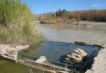
The Rio Grande River....
Six inches deep....our most southern border!
~~~~~~~~~~~~~
Border poverty is beyond comprehension...until you see the shack villages, where "houses" still have dirt floors and women still wash clothes on flat rocks in the river...
Boquillas, Mexico....

~~~~~~~~~~~~The thermal hot springs were a disappointment. We expected to find 120 degree temps, but discovered that the water was very lukewarm...even on a sunny day. However, the pool was much warmer than the river. I couldn't see myself sitting in that silty water, which clouded each time it was disturbed....and I was nervous about the Mexican observers...
The Springs....

~~~~~~~~~~~~
Boquillas Canyon Overlook is at the end of the east park road.
Boquillas Canyon....

Boquillas Mountain Range...

~~~~~~~~~~~~~~~~
The US government closed the low water border crossing at Rio Grande Village, so we decided to turn around and stop at the park's river side campground to buy a late afternoon snack.
 As you can see, interesting folks camp there...some from as far away as Victoria, Texas. Some travel strictly with tents, while others drive the most expensive motor homes...quite a diverse mix of class and race in such a small space!
~~~~~~~~~~~~~~ There are over 2 dozen lions in the park, where they sometimes use man made trails. There are black bear also!


There are over 20 bears in the park! You may ask, "What do they eat in this kind of environment?" After disappearing from this area for over 50 years, bears began migrating out of the Mexican Sierra mountains back to the park in the late 1980's. They eat a variety of nuts, cacti fruit, sotol and yucca hearts, and smaller quantities of smaller mammals, reptiles and carrion.
~~~~~~~~~~~~
The second day would finish our short tour of Big Bend. We planned to see everything west of The Basin to the Santa Elena Canyon. This would include many more fabulous vistas, an old calvary trading post/fort, a wind-blown abandoned adobe homestead outside Castolon, the magnificent canyon, and the many off-pavement miles of desert scenery....including "Luna's Jacal."
After the park we planned to stop in old town Terlingua and the Big Bend Ranch State Park Visitor's center...
After we arrived at the visitor's center and after a few moment's chat with the park ranger, Vickie rediscovered old friends who had moved to the region 30 years ago. Small world this Texas...for the old time natives anyway....
Trekking westwards on Route 170, down the awesome "River Road" between Lajitas and Presidio, we spent the extra time to take one of the top ten scenic drives in the United States. We pulled over to make photos of the river canyons and the teepee rest park, and then further explored "The Blind Canyon." See pics below...
~~~~~~~~~~
Sotol Valley....
 "DON'T PICK THE STALKS VICKIE!!!"
A large wilfire decimated the sotol in this Big Bend valley, but afterwards, within a few years, the valuable sotol had returned doubled in numbers. Mother Nature takes care of herself....
Sotol Valley Overlook...

~~~~~~~~~~~~~
The Rock Dinosaur
Frozen in time....


Standing on the edge of a mesa like this is like standing on the edge of time...
The Dorgon mesa was flat on top, about 500 feet above the river plain.


Look at the width of these walls....

 I am standing by a massive petrified rock, double fireplace in the center of the adobe...
~~~~~~~~~~~~~
The Santa Elena Canyon....

Here is where the Rio Grande becomes a mighty monster...when the water is high! A river runner's delight and farmer's floodwater nightmare!
~~~~~~~~~~~~
The Old Maverick Road....
Only a short 12 miles to pavement!

If you drive a truck and don't mind riding for an hour on a dirt "road" worse than a deep ribbed washboard, then take the short cut to Study Butte! The up close scenery and wash outs are worth seeing. Along this road you will pass buy Luna's Jacal.... STOP to look at it and read the marker sign.
~~~~~~~~~~~
Luna's Jacal....

"What is an jacal?", you might ask.... "Who was Luna?"
In 1947, at the age of 108, Gilberto Luna drew his last breath within the walls of his own Big Bend penthouse suite, an aged but sturdy jacal (prounounced hah-KAHL) he built himself with mud adobe, stones, ocotillo, dried lechiguilla and creosote - materials that were close at hand. In the distance, a spectacular view of Santa Elena Canyon rises above the desert floor, made more beautiful with each sunrise and sunset.
Farming near Alamo Creek, Gilberto Luna raised melons and beans...and children; 38 in all, born by six different successive wives. He made peace with the raiding indians, and the bright full Comanche Moon.
Some would say Gilberto was impoverished, uneducated. Perhaps so in the measurements of modern-day existence, but I doubt Gilberto would agree. He awoke to nature's grandeur each day; his ability to survive and flourish a testament not only of tenacious human will over immense obstacles, but also a tribute to intelligence and a special communication with the land.
I am humbled by Gilberto Luna.....

I had to "steal" this interior photo of the jacal off the internet...as I wanted you to see the construction use of natural materials. Ocotillo was used for the rafters! YIKES! Don't bump your head....
The interior of the jacal stays an average temperature of 75 degrees, even when the desert temps rise over 180 in the summertime!
I'm guessing that none of the Luna family were over four feet tall!
~~~~~~~~~~
PIT STOP....TERLINGUA...LAJITAS....
 Most folks buried here in the Terlingua Cemetery died during the flu epidemic of 1918. I wondered how the flu arrived here...so far from civilization...
The original plan was to see if any famous outlaws had grave markers here...but most of the graves were unidentifiable after years of hot wind, dust, heat, etc....

We drove through Lajitas due to time constraints. Pressed for daylight, we wanted to walk the Blind Canyon on further down the road. But as you can see by this stolen pic, it might be worth a second trip to see the old calvary fort and ghost town...and maybe take a river ride tour too!
~~~~~~~~~~~~
The Blind Canyon....
Vickie looks very small in the Blind Canyon. One would not want to be anywhere near the canyon during a desert "sprinkle," as the rain water would build to over forty feet high in just minutes, as it rushed downward through the canyon to a small opening in the mountain just above the Rio Grande. SO...if you hear a clap of thunder or feel a splat of rain from above...
RUN FOR YOUR LIFE!!!


If you have never been to Big Bend National Park....GO! There are so few words to describe its beauty. Eons of time live there amongst the snakes and rocks. The "largeness" of it will amaze you....as it is miles upon miles of uninterrupted, every-changing, jaw dropping scenery.
Between 1933 and 1942, $1.5 million dollars were used to purchase 600,000 acres of arid west Texas land from private landholders. Not all wanted to sell. One mother, whose oldest son was fighting in Europe, wrote President Roosevelt a letter, imploring him to save the family ranch for her son's sake.
"I wish that you might read some of his letters in which he writes about the hills, canyons, and trails that he longs for at home." This soldier's home was given away on D-Day, when he was fighting for freedom. On June 12, 1944, while thousands were dying on the beachheads of Europe, Big Bend National Park opened its gates for business....
Go here to see more:
http://www.nationalparkreservations.com/info/bigbend/?gclid=COnjmebO6KACFSgnawodQyHfHg

~~~~~~~~~~~~~~~~
Easter weekend, 2010, we made a last minute decision to drive 12 hours west on I-10 to see Big Ben National Park... Talk about a LONG drive! Next time, we will fly to El Paso and drive east to the park....hint hint!
Texas is so big that the western counties raise the speed limit because there is NOTHING to get in your way except cars passing yours like they were on the auto bahn! Check out this speed limit sign just past Sonora...80 MPH!


 Fort Stockton is on the way....so we stopped to make pictures in front of their town motto....a gi-normous Roadrunner (Chapparal)....
BEEP BEEP!!!!
~~~~~~~~~~~~~~~
Marathon, a tiny town out in the middle of nowhere, represents the effort it takes to live in this region. There is no rain...so nothing rots or rusts...much. Pics of this former train depot and cars parked around it reflect how long it has been since this dry spot in the road saw life....


~~~~~~~~~~~~~~~
We made it!
 At 3:55 p.m., we were one of the last few cars to enter the park. Five minutes later would have yielded a long drive back to tiny Marathon! But not as far as the next 40 miles at 40 MPH!
That is how large Big Bend is....forty miles to the Park Headquarters at the park's center! The late afternoon temperature on the desert floor registered 99 degrees.... Park Rangers, at the entrance, told us that August desert floor temperatures average 180 degrees! That month would NOT be a good time to visit....

That is how large Big Bend is....forty miles to the Park Headquarters at the park's center! The late afternoon temperature on the desert floor registered 99 degrees.... Park Rangers, at the entrance, told us that August desert floor temperatures average 180 degrees! That month would NOT be a good time to visit....
UGH....soooo slow after driving 80+ mph....
~~~~~~~~~~~~~~~
Before reaching the road that runs to west to Study Butte ("Stoody Byoot") and The Basin, we observed a young man walking a mountain bike along the paved park road. As we passed, Vickie noted that he looked hot and tired...so she insisted we stop to check on him. He had been out of water for hours since leaving his base camp that morning. The park map made the back-road desert trek seem small and the weather was cool that morning when he struck out by himself on a short "round-the-park" jaunt. Did he forget that Big Bend is part of the Chihuahuan DESERT !
Before reaching the road that runs to west to Study Butte ("Stoody Byoot") and The Basin, we observed a young man walking a mountain bike along the paved park road. As we passed, Vickie noted that he looked hot and tired...so she insisted we stop to check on him. He had been out of water for hours since leaving his base camp that morning. The park map made the back-road desert trek seem small and the weather was cool that morning when he struck out by himself on a short "round-the-park" jaunt. Did he forget that Big Bend is part of the Chihuahuan DESERT !
 So as I threw his bike into the truck bed, he crawled in behind, guzzling the bottle of water that Vickie had handed him... The cool breeze must have felt nice on his parched skin as we eased on down the road. Nervous that we would not make camp before dark, we decided to leave him at the Panther Junction crossroad because it looked like the last 25 miles of his trip was downhill. All he had to do was hang on to the handlebars and coast.
 We wondered as we drove off what would have happened if the biker had dropped on the trail. How long would it have been before the buzzards found him....dried up like a prune?
Hopefully he made it back to camp before dark, as the dark in Big Bend is like no other...
It is such a BLACK dark that it makes the stars seem like you can grab them from the skies.
The light chart and pic below shows how "black" the Big Bend is....


~~~~~~~~~~~~~~~~~
Before reaching camp, we stopped to photograph this tall spiky plant, known as the "Sotol"... Most think it is a cactus, but it is really an evergreen rosette, whose leaves were once used by native Jumano Indians to weave into tradable mats, trays, burden baskets, tumplines, and general purpose baskets.

It's starchy core was their primary food, which were roasted in dug out pits and then eaten like baked potatoes. Sometimes the pulpy central stems or "hearts" of sotol plants were baked and then pounded and formed into chewy patties which could then be dried and stored. Fascinated by this all purpose plant, I later learned that its juice tastes like nutty molasses syrup.
A finicky plant...it grows only on north facing slopes, which typically catch the most rain. The fruit stalk often grows 30 feet tall, dying after blooming. However, the remaining stalk can be harvested and used for many things. It is as light as balsa wood, but durable as walnut. Once out the park, we stopped along the roadside and harvested several. We will later make them into lightweight walking sticks for future treks and to give as presents.
Vickie Harvesting Sotol....

~~~~~~~~~~~
Finally reaching our destination, we drove through the pass into an ancient mountain crest known as "The Basin," which is the location of the primary park "lodge"....with gift shops, old spanish colonial style cabinitas, a "micro-store" for campers, an interesting desert-styled Information Center, and an expensive, low quality restaurant. The mountain is named:
El Capitan...
The sun drops quickly in the desert, so as we crested the ridge, below is the stunning view of what we saw. This view is known around the world as
"The Window" ...


The sun drops quickly in the desert, so as we crested the ridge, below is the stunning view of what we saw. This view is known around the world as
"The Window" ...

After check-in, we donned our jackets, grabbed a lounge chair on the lodge porch and watched the sun disappear into the west.
~~~~~~~~~~~~~
The air temperature dropped to 42 degrees and the wind began to blow through the pinon pine as we snuggled into an adobe-like cabin on the mountainside....

"The Roosevelt"....

~~~~~~~~~~~~~~~~~
After a "manly" lodge breakfast the next morning, I decided (much to Vickie's surprise) to make a climb. Argh Argh Argh... The restaurant vista made the kopje (African word for small rocky hill) appear easy...so off I hiked! Here are photos of me and "The Mountain."
As you can see...the mountain was bigger than I thought!
"The Vista"....

The Climb...see me???
Notice the buzzard in the background...just coasting...waiting for me to fall !

Ta Dah!
I made it to the top...almost...

~~~~~~~~~~~~
After a late breakfast and a breakneck climb, we decided to see the eastern half of Big Bend the first day. We crossed the desert floor, after stopping at the cross-roads visitor's center, and headed DOWN towards the river...on the same paved road the biker went the night before.The desert floor was covered with this cactus-like plant called Ocotillo(Oca-teeyo). It's an unusual plant that is used for many things...as its stems, which grow up to 15 feet tall, are covered with thousands of spiny sharp tines. The shrubs cut "limbs" are often used as "fencing" because its spines stop people and animals from passing through.

Even when you plant dead ocotillo in the ground for fencing, they come alive and create a living fence of hell!

However, after spring rains, the plant blooms, see in a pic below, and is beautiful.


Our goal for the day was to reach the Boquillas Canyon Overlook (at the remote eastern edge of the park) and to soak in the hot springs by the river.
~~~~~~~~~~~~~~
When walking down the gravel path at the river's edge, we noticed a cache of handmade goods resting on a flat rock.
When walking down the gravel path at the river's edge, we noticed a cache of handmade goods resting on a flat rock.
The Offering...

There were wire scorpions, pieces of red calcite, hand painted sotol walking sticks, etc... We stopped to examine this stuff when Vickie noticed the binoculars peering at us through the cane rushes across the river. Since it is illegal to purchase transported, untaxed goods across the US border, we won't say that we bought a piece a calcite, via a shouted negotiated price in Spanish from across the river NOR will we say we deposited "tres dollares" into a very visible jar on the rock! However, we did notice afterwards that a mexican simply waded across the river to collect his jar of money.
The Mexicans...

The Rio Grande River....

Six inches deep....our most southern border!
~~~~~~~~~~~~~
Border poverty is beyond comprehension...until you see the shack villages, where "houses" still have dirt floors and women still wash clothes on flat rocks in the river...
Boquillas, Mexico....

~~~~~~~~~~~~The thermal hot springs were a disappointment. We expected to find 120 degree temps, but discovered that the water was very lukewarm...even on a sunny day. However, the pool was much warmer than the river. I couldn't see myself sitting in that silty water, which clouded each time it was disturbed....and I was nervous about the Mexican observers...
The Springs....
~~~~~~~~~~~~
Boquillas Canyon Overlook is at the end of the east park road.
Boquillas Canyon....

Boquillas Mountain Range...

~~~~~~~~~~~~~~~~
The US government closed the low water border crossing at Rio Grande Village, so we decided to turn around and stop at the park's river side campground to buy a late afternoon snack.
New Age Cowboys....
 As you can see, interesting folks camp there...some from as far away as Victoria, Texas. Some travel strictly with tents, while others drive the most expensive motor homes...quite a diverse mix of class and race in such a small space!
~~~~~~~~~~~~~~
We drove back to the basin, thinking we would hike the Window Trail for a sunset opportunity, but after hearing about the mountain lion spotted earlier in the day on the trail, we decided to just watch it drop, while dining over dinner at the restaurant!
West Texas Mountain Lion....


There are over 20 bears in the park! You may ask, "What do they eat in this kind of environment?" After disappearing from this area for over 50 years, bears began migrating out of the Mexican Sierra mountains back to the park in the late 1980's. They eat a variety of nuts, cacti fruit, sotol and yucca hearts, and smaller quantities of smaller mammals, reptiles and carrion.
~~~~~~~~~~~~
The second day would finish our short tour of Big Bend. We planned to see everything west of The Basin to the Santa Elena Canyon. This would include many more fabulous vistas, an old calvary trading post/fort, a wind-blown abandoned adobe homestead outside Castolon, the magnificent canyon, and the many off-pavement miles of desert scenery....including "Luna's Jacal."
After the park we planned to stop in old town Terlingua and the Big Bend Ranch State Park Visitor's center...
After we arrived at the visitor's center and after a few moment's chat with the park ranger, Vickie rediscovered old friends who had moved to the region 30 years ago. Small world this Texas...for the old time natives anyway....
Trekking westwards on Route 170, down the awesome "River Road" between Lajitas and Presidio, we spent the extra time to take one of the top ten scenic drives in the United States. We pulled over to make photos of the river canyons and the teepee rest park, and then further explored "The Blind Canyon." See pics below...
~~~~~~~~~~
Sotol Valley....
 "DON'T PICK THE STALKS VICKIE!!!"
A large wilfire decimated the sotol in this Big Bend valley, but afterwards, within a few years, the valuable sotol had returned doubled in numbers. Mother Nature takes care of herself....
Sotol Valley Overlook...

~~~~~~~~~~~~~
The Rock Dinosaur
Frozen in time....

Just past the "Tuff canyon", we spied this unusual outcropping. It looked like a mountainous dinosaur grazing on a mesa. I was asked to stop for a photo. WHAT DO YOU THINK?
~~~~~~~~~~~~~
Castolon Visitor's Center...
An old adobe US Calvary outpost....
 We got a drink and stood in the sun, while a park volunteer demonstrated the mixing and forming of adobe bricks.
Adobe Recipe:
2 gallons horse dung
5 gallons river silt
5 gallons water
Mix by hand, dump into molds, dry in desert sun one day.
To make a one room shack that is 15 foot square and 8 foot tall, you would need to make at least 1,248 bricks (14x12x10).
~~~~~~~~~~~~
The Albert Dorgan Adobe....
The Dorgan's had a commanding view of their river bottom candlewax (lechiguilla) farm operation from the bluff above the floodplain, just below the Santa Elena Canyon.
~~~~~~~~~~~~~
Castolon Visitor's Center...
An old adobe US Calvary outpost....
We got a drink and stood in the sun, while a park volunteer demonstrated the mixing and forming of adobe bricks.Adobe Recipe:
2 gallons horse dung
5 gallons river silt
5 gallons water
Mix by hand, dump into molds, dry in desert sun one day.
To make a one room shack that is 15 foot square and 8 foot tall, you would need to make at least 1,248 bricks (14x12x10).
~~~~~~~~~~~~
The Albert Dorgan Adobe....
The Dorgan's had a commanding view of their river bottom candlewax (lechiguilla) farm operation from the bluff above the floodplain, just below the Santa Elena Canyon.


Standing on the edge of a mesa like this is like standing on the edge of time...
The Dorgon mesa was flat on top, about 500 feet above the river plain.


Look at the width of these walls....


~~~~~~~~~~~~~
The Santa Elena Canyon....

Here is where the Rio Grande becomes a mighty monster...when the water is high! A river runner's delight and farmer's floodwater nightmare!
~~~~~~~~~~~~
The Old Maverick Road....
Only a short 12 miles to pavement!

If you drive a truck and don't mind riding for an hour on a dirt "road" worse than a deep ribbed washboard, then take the short cut to Study Butte! The up close scenery and wash outs are worth seeing. Along this road you will pass buy Luna's Jacal.... STOP to look at it and read the marker sign.
~~~~~~~~~~~
Luna's Jacal....

"What is an jacal?", you might ask.... "Who was Luna?"
In 1947, at the age of 108, Gilberto Luna drew his last breath within the walls of his own Big Bend penthouse suite, an aged but sturdy jacal (prounounced hah-KAHL) he built himself with mud adobe, stones, ocotillo, dried lechiguilla and creosote - materials that were close at hand. In the distance, a spectacular view of Santa Elena Canyon rises above the desert floor, made more beautiful with each sunrise and sunset.
Farming near Alamo Creek, Gilberto Luna raised melons and beans...and children; 38 in all, born by six different successive wives. He made peace with the raiding indians, and the bright full Comanche Moon.
Some would say Gilberto was impoverished, uneducated. Perhaps so in the measurements of modern-day existence, but I doubt Gilberto would agree. He awoke to nature's grandeur each day; his ability to survive and flourish a testament not only of tenacious human will over immense obstacles, but also a tribute to intelligence and a special communication with the land.
I am humbled by Gilberto Luna.....

I had to "steal" this interior photo of the jacal off the internet...as I wanted you to see the construction use of natural materials. Ocotillo was used for the rafters! YIKES! Don't bump your head....
The interior of the jacal stays an average temperature of 75 degrees, even when the desert temps rise over 180 in the summertime!
I'm guessing that none of the Luna family were over four feet tall!
~~~~~~~~~~
PIT STOP....TERLINGUA...LAJITAS....

The original plan was to see if any famous outlaws had grave markers here...but most of the graves were unidentifiable after years of hot wind, dust, heat, etc....

We drove through Lajitas due to time constraints. Pressed for daylight, we wanted to walk the Blind Canyon on further down the road. But as you can see by this stolen pic, it might be worth a second trip to see the old calvary fort and ghost town...and maybe take a river ride tour too!
~~~~~~~~~~~~
The Blind Canyon....

Vickie looks very small in the Blind Canyon. One would not want to be anywhere near the canyon during a desert "sprinkle," as the rain water would build to over forty feet high in just minutes, as it rushed downward through the canyon to a small opening in the mountain just above the Rio Grande. SO...if you hear a clap of thunder or feel a splat of rain from above...
RUN FOR YOUR LIFE!!!

~~~~~~~~~~~
Tee Pee Rest Area....
From the rest area, one can see the spectacular view of the "Black Canyon".
Next stop Presidio, TX where we decided to turn north towards Alpine and then home.


~~~~~~~~~~~~"Do we actually HAVE a border Mr. President?"....On the way to Presidio, we noticed an unusual feature of our nation's southernmost border. After passing a US border patrol truck, we drove a high wire...that stretched across the river. Our eyes followed the wire to a cave that had been tunneled out of a cliff face on the Mexican side, high above the river. It intrigued us so much that we turned around to make photos. It was then that we noticed the motorized car on the US side that traversed the guidewires across the river. We noticed that the border patrol paid no attention to it at all..... VERY INTERESTING! You can see the aperture and the car in the pics below...


~~~~~~~~~~~~
My Texas Cowgirl...
...invites each of you readers to visit Big Bend National Park....
"It's the only way anybone can experience how Texas once was"....as she and her family once knew it....
WILD...FENCE FREE...INDEPENDENT....

SECEDE, TEXAS, SECEDE!!!

Subscribe to:
Posts (Atom)
